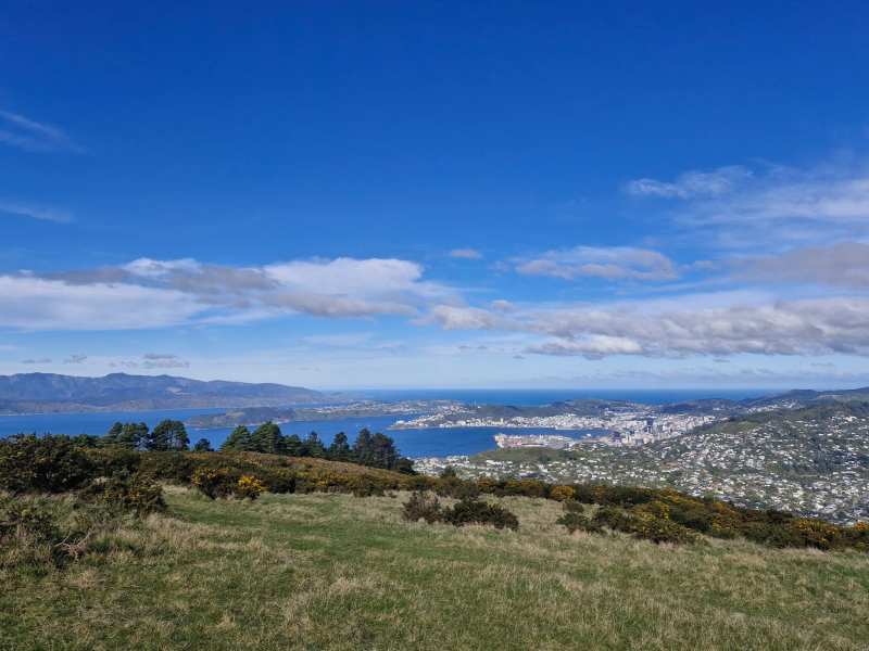
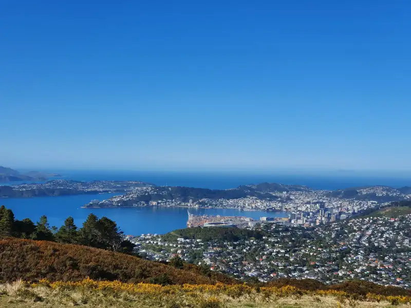
Wellington is a city where the bush starts at the end of the street. The Town Belt wraps green hills around the centre, the Outer Green Belt runs along the ridges behind the suburbs, and the south coast faces straight into Cook Strait. That makes Wellington walks unusually varied for a capital: a twenty-minute climb to a lookout from Courtenay Place, a full day on an exposed ridge above the city, or a flat gravel track to a seal colony.
Here are twelve of them, grouped by how much time and effort they take, each with distance, time and climb, where to start, and how exposed it is to the wind. The wind matters more than the gradient. A walk that is a pleasure in a light breeze can be miserable in a gale.
Wellington's walks also come with a lot of detail that the maps leave out: which way the wind hits a ridge, where the toilets are, which track is really a four-wheel-drive road, and which ones close for lambing. That is what the notes under each walk are for.
Quick picks
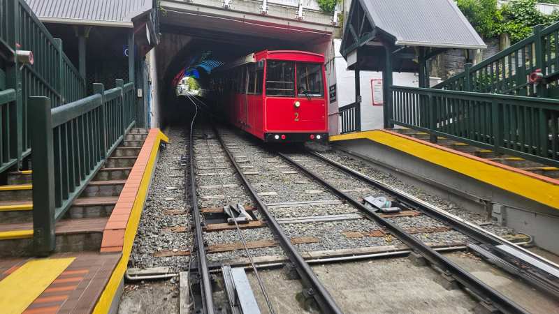
With one hour and no car: Mount Victoria from Courtenay Place, or the cable car up and the Botanic Garden down.
With a morning: Te Ahumairangi Hill from Thorndon, Otari-Wilton's Bush, or Mount Kaukau from Khandallah.
With a full day and good weather: the Skyline Walkway, or the Southern Walkway from Oriental Bay to Island Bay.
For wildlife: Zealandia for birds, Red Rocks for seals between May and October.
For a southerly day: Otari-Wilton's Bush or Zealandia, deep in sheltered bush. For a northerly day: the south coast, Red Rocks or the Eastern Walkway.
Choosing a walk by the weather
The single most useful habit is to check the wind direction before you choose a walk, not just the forecast.
A northerly, the city's most common wind, funnels through the central city and roars across the western ridges, the Skyline Walkway and Mount Kaukau in particular. On a northerly day, the south coast is often the calmest place in the city.
A southerly comes straight off Cook Strait, colder and often wetter, and turns the south coast wild: the Red Rocks walk and the Southern Walkway's coastal stretch become hard work. On a southerly day, the sheltered bush walks of the Town Belt, Otari-Wilton's Bush and Zealandia are the better choice.
On the rare still day, go high. The ridge walks are at their best when there is no wind, and the views stretch across the strait to the South Island.
The twelve walks
1. Mount Victoria from town
Distance: 2.6 km lookout loop or 4.6 km full loop. Time: 45 minutes to 1.5 hours. Climb: to the 196-metre summit. Start: Majoribanks Street or Courtenay Place. Exposure: sheltered on the way up, exposed at the top.
2. The Matairangi nature trail
Distance: short loops on the upper slopes of Mount Victoria. Time: under an hour. Climb: gentle. Start: from the Mount Victoria tracks. Exposure: sheltered.
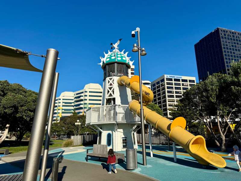
The Matairangi nature trail on Mount Victoria is built for children, with habitat stations, a tree house and a log slide along the way. It is the easiest way to turn a walk into an adventure for small legs, and it combines easily with the lookout.
3. The Botanic Garden and the City to Sea Walkway
Distance: 30 to 45 minutes downhill through the garden, longer if you follow the City to Sea Walkway. Climb: downhill from the cable car, or steep uphill the other way. Start: top of the Wellington Cable Car in Kelburn. Exposure: mostly sheltered.
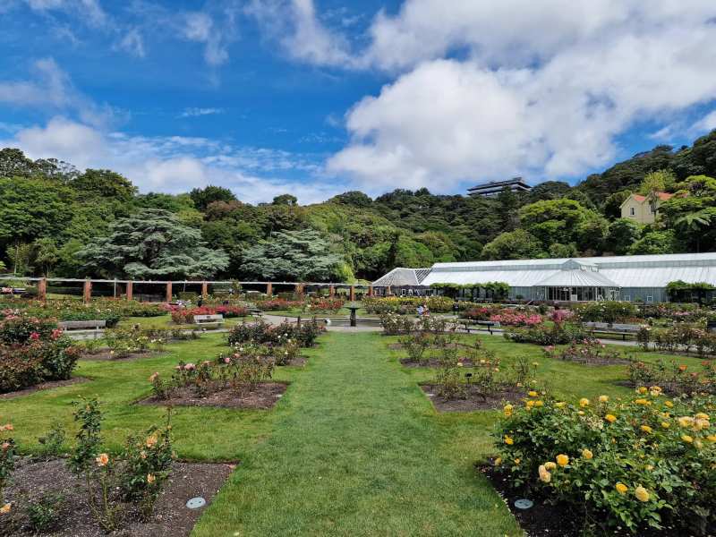
The simplest good walk in Wellington is to ride the cable car up to Kelburn and walk down through the Wellington Botanic Garden. The City to Sea Walkway continues south from the garden through Kelburn Park, the Aro Valley and the Town Belt to the south coast at Island Bay, a longer route that stitches the city's green spaces together.
4. Te Ahumairangi Hill
Distance: a network of tracks over more than 100 hectares. Time: 1 to 2 hours. Climb: moderate. Start: Grant Road, Thorndon. Exposure: mostly sheltered, open at the lookout.
Te Ahumairangi Hill, the old Tinakori Hill, rises directly behind Thorndon and the Parliament buildings. Its tracks climb through forest to a lookout straight down onto the Beehive and across the harbour. It is quieter than Mount Victoria and much less visited by tourists.5. Otari-Wilton's Bush
Distance: several short forest loops. Time: 1 to 2 hours. Climb: gentle to moderate. Start: 150 Wilton Road, Wilton. Exposure: sheltered.
6. Zealandia
Distance: a network of tracks through the sanctuary valley. Time: 2 to 4 hours. Climb: gentle along the valley floor, steeper on the side tracks. Start: 53 Waiapu Road, Karori. Exposure: sheltered in the valley.
Zealandia is a 225-hectare predator-free valley surrounded by a fence, full of native birds rarely seen on the mainland. Walking here is slower than elsewhere because you keep stopping to look. It is open from 9am to 5pm, last entry at 4pm, and there is an entry charge.7. Mount Kaukau
Distance: a short, steep route from the Khandallah trailhead. Time: 1 to 1.5 hours return. Climb: steady, to the 445-metre summit. Start: Simla Crescent, Khandallah. Exposure: very exposed at the top.
8. The Skyline Walkway
Distance: 18 km end to end, walkable in sections. Time: 5 to 6 hours for the full route. Climb: several hundred metres of ups and downs along the ridge. Start: Old Coach Road, Johnsonville, or Makara Saddle, Karori. Exposure: fully exposed.
On a northerly day the ridge is brutal, and in cloud it is disorientating. Check the forecast, carry water and a warm layer, and turn back if the wind gets up. There is no shelter along the top.
9. The Northern Walkway
Distance: 14.9 km. Time: at least 4 hours. Climb: moderate. Start: Johnsonville, or the Town Belt at Te Ahumairangi Hill. Exposure: mixed.
The Northern Walkway links the Town Belt above the city with the Outer Green Belt, running from Te Ahumairangi Hill through Trelissick Park and Khandallah to Johnsonville. It is a good one-way walk with a train back into the city from Johnsonville. Trelissick Park along the way has steep, well-formed tracks, an off-leash dog area and gunpowder magazines from the 1870s.
10. The Southern Walkway
Distance: 10.6 km. Time: 4 to 5 hours. Climb: around 350 m in total. Start: Oriental Bay or Island Bay. Exposure: mixed, exposed on the coastal end.
The Southern Walkway crosses the city from the harbour to the south coast, from Oriental Bay over Mount Victoria, through the Town Belt and down to Island Bay. It passes lookouts, suburbs and bush, and ends at the rock pools and marine reserve at Island Bay. Walk it north to south and finish with lunch by the sea, then take the bus back.
11. The Eastern Walkway
Distance: 2.5 km one way, about 5.7 km as a loop. Time: 1 to 2 hours. Climb: about 200 m. Start: Tarakena Bay or Pass of Branda, Strathmore Park. Exposure: exposed.
12. Red Rocks and the seals
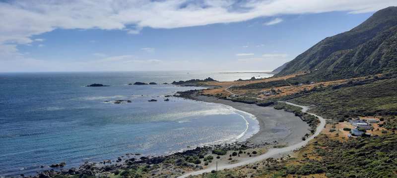
Distance: about 7.5 km return. Time: 2 hours. Climb: almost flat. Start: Te Kopahou visitor centre, end of Owhiro Bay Parade. Exposure: fully exposed to southerlies.
The track starts in Te Kopahou Reserve, where there is parking and toilets, and on Sundays it is closed to vehicles. For something steeper nearby, the Tip Track climbs up exposed ridgelines above the reserve.
One more for the adventurous: Makara Beach
The Makara Beach Walkway on the wild west coast, out past Karori on Makara Road, is a loop of about 6.7 km that climbs over farmland to views of the coast and historic gun emplacements on the headland. It is an advanced track, steep in places, and closes for lambing in late winter and early spring, usually August and September. Check before you go.
Walks with children
The best family walks in the city are short and have a reward. The Matairangi trail on Mount Victoria has its tree house and slide. The Botanic Garden walk down from the cable car ends at a playground and the rose garden. Otari-Wilton's Bush has short loops and a canopy walkway that children enjoy. Zealandia keeps them looking for birds the whole way round.
For older children, Red Rocks is flat enough for most, and the seals are a powerful incentive in season. Keep them well back from the animals and away from the water's edge in a big swell.
Walks with dogs
Dogs are welcome on many of Wellington's Town Belt and reserve tracks, usually on a lead, and the city has designated off-leash exercise areas. Tawatawa Reserve in Island Bay, a 64-hectare area of regenerating bush and wetland, has an off-leash dog exercise area, and Trelissick Park has one too.
Dogs are not allowed in Zealandia, where they would threaten the birdlife, and are restricted in Otari-Wilton's Bush. Rules on beaches change seasonally, and some reserves restrict dogs during lambing or bird-breeding seasons, so check the signs at each trailhead.
Accessible and easy walks
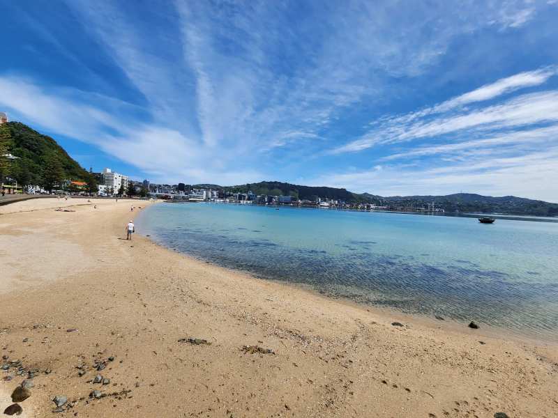
Not every Wellington walk involves a hill. The waterfront from Queens Wharf to Oriental Bay is flat and sealed, suitable for wheelchairs and prams. The Botanic Garden has sealed paths in its lower sections, though the slopes are steep elsewhere. The Red Rocks track is a gravel road, flat but rough, and manageable for most walkers without a wheelchair.
Oriental Parade and the bays beyond it, along Evans Bay Parade, are flat seaside walks with footpaths the whole way, good for a gentle stroll with a coffee at the end.
Staying safe on the tracks
Wellington's walks are close to the city, which can make them feel less serious than they are. The ridge walks, Skyline and Kaukau in particular, are fully exposed, and wind speeds up there can be much higher than in the streets below. Cloud can close in quickly, and the temperature drops sharply with height and wind.
On the south coast, big southerly swells can wash over low sections of the track, and the rocks are slippery. Stay well back from the water in rough seas. Mobile coverage is good on most city walks, but patchy on the far side of the ridges and around Sinclair Head.
The basic rules are the usual New Zealand ones: check the forecast, tell someone your plan, carry a warm layer and water, and turn back early rather than late.
Walks by season
Summer, from December to February, has the longest days and the calmest spells, and the best conditions for the ridge walks and the full Southern Walkway. Autumn often brings the stillest weather of the year, with crisp mornings and clear views. Winter is the season for the sheltered bush walks and the seals at Red Rocks. Spring is windy, but the Botanic Garden and Otari are at their best, and the tūī and kererū are busy in the Town Belt.
Getting to the trailheads and back
Most trailheads are reachable by Metlink bus or train. Johnsonville, for the Northern and Skyline walkways, is on the train line from Wellington Station. The Mount Victoria and Southern Walkway starts are walking distance from Te Aro. Owhiro Bay, for Red Rocks, is on the bus network, with a walk to the start of the track.
One-way walks, like the Southern and Northern walkways and sections of the Skyline, work well with public transport: walk out, take the bus or train back. A ride-share app helps for the harder-to-reach ends.
Wellington City Council publishes current track information, including closures, and the Welly Walks app has maps of many of the routes.
What to take
Wellington's weather changes fast, especially on the ridges and the south coast. Take a windproof and waterproof layer on every walk, even in summer, and wear shoes with grip. Carry water and something to eat on the longer walks, as there are few shops at the trailheads. On exposed walks, a hat that stays on in the wind and sunscreen are worth having: the sun is strong, and the breeze makes it easy to forget.
Tell someone where you are going on the Skyline or the Makara walk, and turn back rather than pushing on if the weather closes in.
For the flat, easy harbour walk, the waterfront from Queens Wharf to Oriental Bay is the gentle option.
The south coast beaches pair naturally with the coastal walks, and Wellington's weather is worth reading before choosing a ridge.
Further out, the Escarpment Track and Kāpiti Island are day trips of their own, and the indoor sights fill the days between walks.
Frequently asked questions
Published July 26, 2026